In the morning we set off for Oruro. We knew from Will and Stewart that part of the road was going to be dirt, but forgot to ask about exact details from where to where.
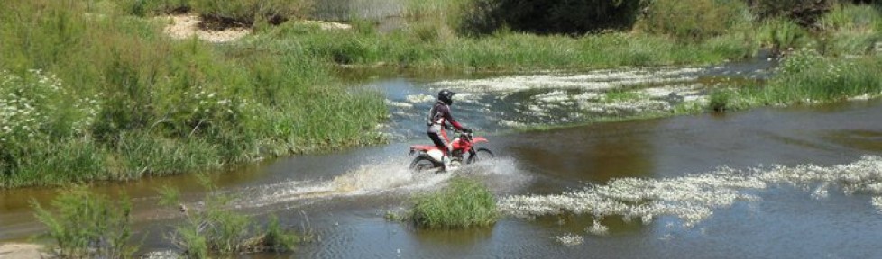
 stunning Bolivia
It seems impossible to get a reliable map of Bolivia. We have yet to find two different products that agree. The one we have is different from the one we borrowed from a german couple in San Pedro de Atacama, which again is different from Google maps that then differ from my Mapsme app on my phone, which is the one we primarily use now. We have had roads marked as dirt roads be paved and villages on one map be simply missing on another.
After just 30km the road turns to dirt. There´s 320km to go to Oruro and all we know for sure is that the last 30 – 40km are paved as well. Could be a long day.

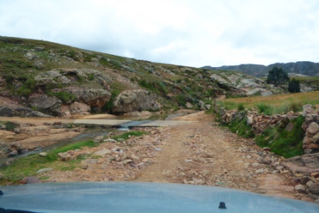
As with most of the dirt roads we have encountered so far, it is slowly being upgraded to paved, but that just means lots of detours due to road work. One of these detours is the most demanding section we have had anywhere so far. It has been raining and still does. Only light rain, but enough to make a dirt road muddy. This detour takes us around a bridge over a stream and has a steep and slippery drop down to the water where we can not quite judge how deep it is. On the other side is a climb that is also a left bend and also muddy.
I am driving today and my biggest worry is the climb. Since the drop is too slippery to brake on anyway I won´t, but if I do not make the climb, we will slide back down to the bottom and basically be stuck there until someone comes by with a vehicle that can pull us out.
Ideal would be one of the bulldozers they use for the roadworks, but are they working on christmas day at 10:00?
I have practically no real offroad experience in a car, but figure the same rules apply as on a bike. Look at where you want to go and DO NOT STOP.
On top of everything the tires have almost no pattern left. We noticed that already taking over the car, but the rental company probably want to save some money by keeping the tires on as long as possible and told us they were good. We´ll see.
I look over at Lorraine. She has got her adventure face on and just gives me a nod of approval. Do it. I go over the side, stick it in second gear and head for the water crossing. The car drifts a little sideways. I hit the gas and it stabilizes. As we approach the water we can see that as expected it is only a few centimeters deep. Good.
Then the climb and I apply some more throttle and adjust the revs with the clutch if needed. Not exactly by the book procedure, but there is a very real risk the hopelessly underpowered cage we are in will stall if there is any kind of change in grip on the hill. The car slips and slides, left turn, just a few more meters now and before we know it we are through and safely back on the track on the other side. I have done it all in one breath and breathe out again. Lorraine puts a hand on my shoulder and gives me a ”well done”.
Challenging road, yeah – whatever.
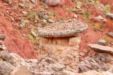 one of the many interesting rock formations we’ve come across
The rest of the trip is easy. Lots of ripples in the road which slows us down, but nothing challenging. Just slow progress. We are getting hungry, and in the small village of Ocuri Lorraine finds a store that has supplies. Sort of.
She comes back with our christmas lunch. Two bananas, a can of pilchards in tomatosauce, for dessert a lovely chocolate cake that is not yet past expiration date and last but not least a nice vintage mineral water. Yummy.
About 20km later we find a nice spot with a nice view and have lunch. The pilchards are eaten straight out of the can with plastic forks like a couple of hobos. The chocolate cake cut with a multitool. Not the ususal christmas lunch feel, but we get a good giggle out of it.
 our ”awesome” Christmas lunch
 Joern did the ”cooking”, what a man

Our progress has been so slow we start realizing, that unless the road improves dramatically, we will not make it to Oruro before dark and might have to sleep in the car. The map shows a road connecting this road with the main road between Potosi and Oruro coming up. We know the main road is paved, but the connecting 35km road is marked as ”secondary dirt road”. The one we are on is a ”primary dirt road”. So the question is, if we should swap 150km of dirt road for 35km of even worse dirt road. Will it save us any time at all? Problem is solved shortly after as we reach the connecting road and it turns out to have been freshly paved and is in perfect condition. So much for map updates.
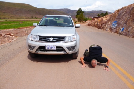 Finally asphalt
I get out of the car and kiss the asphalt. 30 minutes later we connect with the main road to Oruro and arrive just before dark. Oruro is the least interesting place we have been so far. Absolutely nothing looks charming. We find a hotel and the only open restaurant in town. Good business model. There is a 45 minute wait for a pizza, but we sweat it out, eat and head back to the hotel. Next morning as soon as possible we are out of there.
